West Coast Trail 1991
by Mike Thompson, 5/18/2022
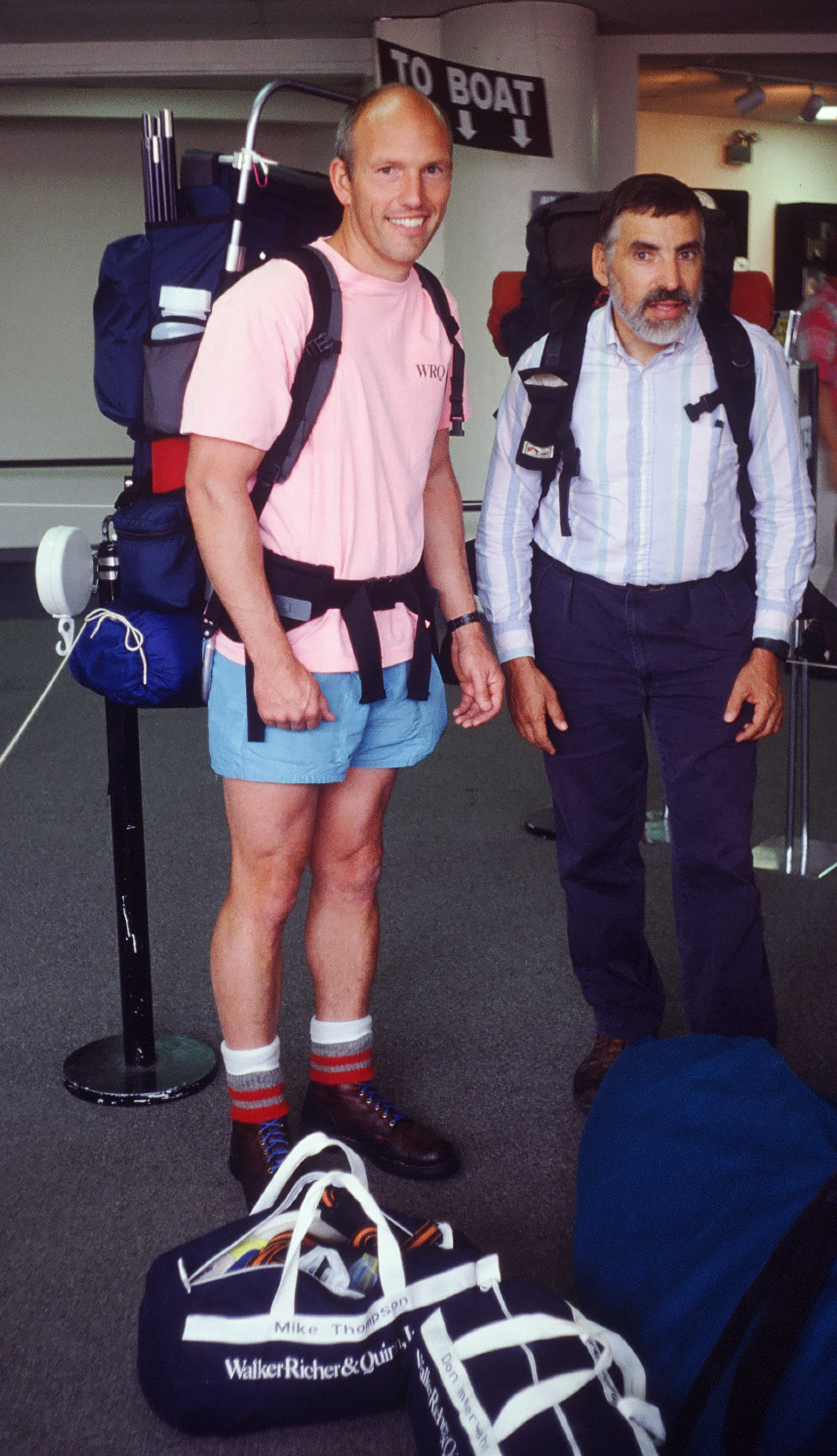
Don Immerwahr, wonderful co-worker and friend, invited me to hike the West Coast Trail on Vancouver Island with him. The trip was a Backpacking 101 course for me, on which I was able to learn the ropes from a thoughtful teacher with tremendous backpacking and climbing experience. After finishing the WCT with Don, I knew how to select proper gear and clothing, find good maps, navigate, and cook. With the skills needed to be able to lead trips with friends and family, my backpacking days had begun! For the gift of backpacking I will always be grateful to Don.
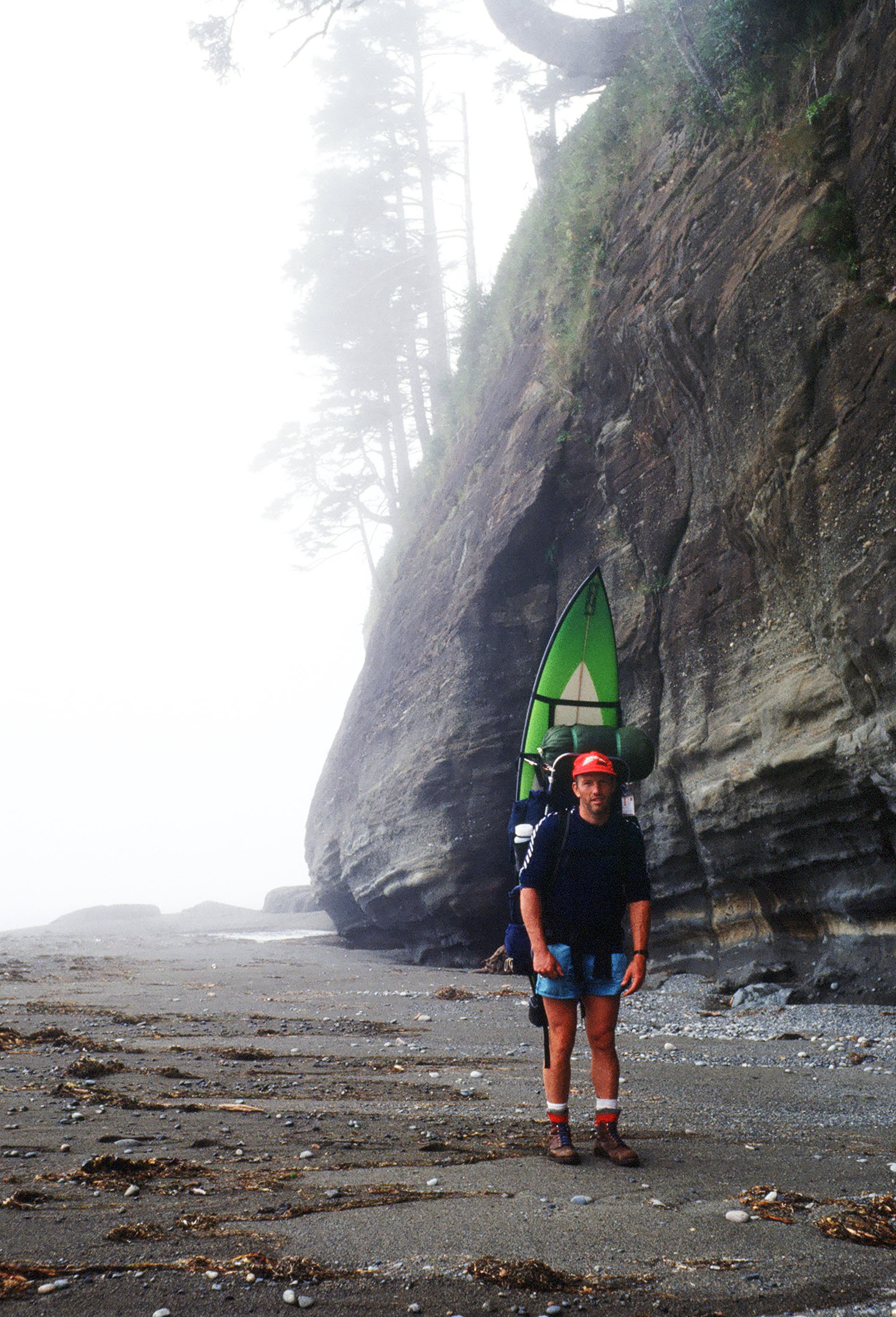
In the mid to late 1980's I had been doing some hiking and climbing in the Cascades, most often day trips led by Doug Walker of WRQ. During this period I was also doing a lot of surfing, combing the coastlines of northern Oregon, Washington, and eastern Vancouver Island in search of surfable waves. I asked Don if I could bring a surfboard along on the hike, to which he agreed with some reluctance. My wonderful wife, Jane then sewed up a harness so that I could carry my 7' 4" surfboard just behind my backpack. The harness worked well, with only a few occasions when the surfboard made it difficult to get through the forest. Even though I was only able to surf once along the way, the "surfari" component of the trip made it even more memorable.
Saturday, 9/7/1991
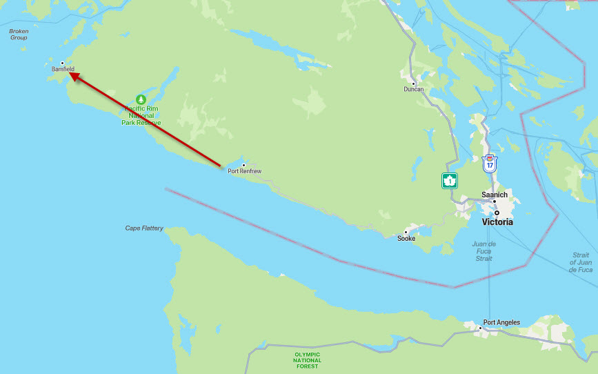
Got up at 5:30 AM, had breakfast at Denny's, and checked out of our hotel in Victoria, British Columbia. At 7:00 AM the shuttle bus arrives to pick us up. Picked up seven other hikers on the way out of town, including four women from Vancouver/Penticton, a Canadian couple (the guy has done the West Coast Trail twice before), and a Welshman. Arrived in Port Renfrew about 9:30 AM and checked into the Parks Department registration center, where we got our tag, a tide table, and trail info. Got back on the bus, drove into Port Renfrew proper, and were let off at the dock. At about 10:00 AM the boat arrived to pick us up and take us to the trailhead. It was a 20-foot, flat-bottomed, aluminum barge with an outboard, commanded by an old salt who's picture I wish I had taken. It was just a short ride across the sound to Thrasher Cove, where we got off the boat and our hike began.
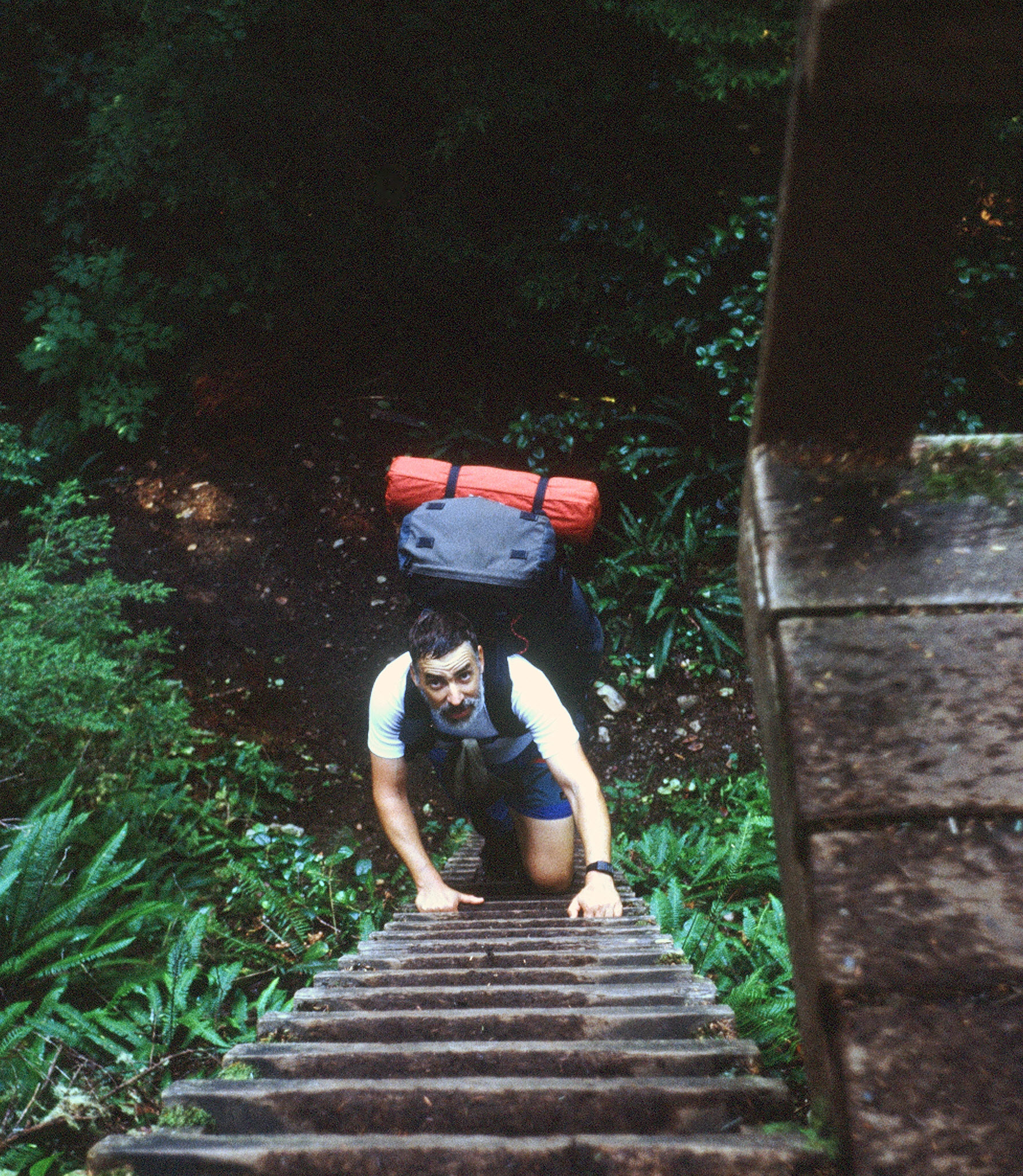
Climbed up a series of ladders out of Thrasher Cove, then up a switchbacked trail until we connected with the West Coast Trail, where we took a left and started on our way west at the 70 Kilometer marker. Spent the rest of the morning and the early afternoon hiking the sort of trail we became accustomed to the first three days of the trip. Plenty of mud and slippery tree roots, with lots of log bridges, wooden walkways, and ladders. The southern part of the WCT is supposed to be the harder stretch, and we were glad to know that, otherwise our slow progress on the first day would have been doubly discouraging.
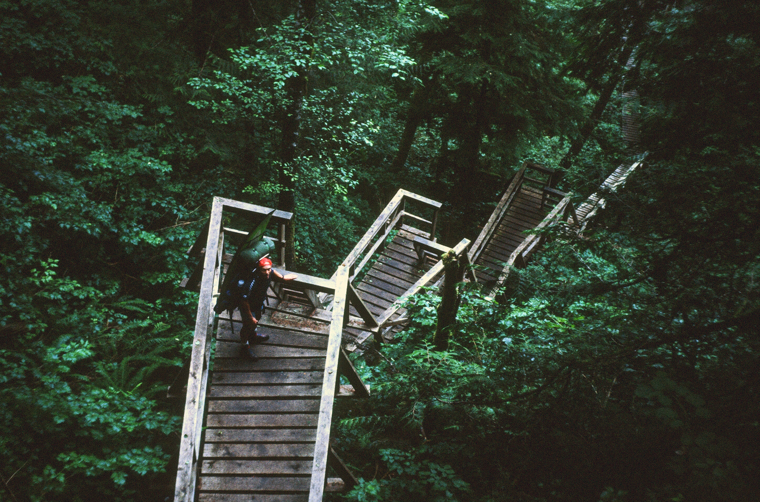
We got our first look at the Pacific Ocean at Kilometer 66, and it was a beautiful sight. There are no beaches along this part of the trail - only a wide, flat, sandstone shelf with small breaks at the larger creek mouths: Camper Creek, Sandstone Creek, Cullite Creek, and Logan Creek. The most interesting shoreline feature is called a surge channel. At points you'll come across a crack or a weak seam in the sandstone shelf that has been hollowed out by the waves. These surge channels run perpendicular to the shoreline and are typically around twenty feet wide, from six to ten feet deep, and can run from the ocean all the way up to the base of the cliffs.
These surge channels can be impassable, having steep, smooth sides covered in slick seaweed. Some are passable only at low tides, and one we encountered between the mouths of Camper Creek and Sandstone Creek was only passable from east to west, not in the other direction. You do not want to find yourself in a surge channel when a big wave comes crashing in! These surge channels are not to be taken lightly, as they have claimed many lives. If a sneaker wave slams you against a rock and then drags you out to sea while you're strapped in a fifty-pound backpack, the party's over.
Our first night was at Camper Bay, where Camper Creek empties into the ocean. There's a break in the sandstone shelf right at the creek mouth that's approximately fifty yards wide. We found a nice camping spot on the sand near the ocean. No surfing opportunity here (nor were there any at the other creek mouths that we would visit the first 2 1/2 days of the trip).
Sunday, 9/8/1991
Up at 5:30 AM and got packed as fast as we could, skipped breakfast, and hit the shelf (as opposed to hitting the trail). The sandstone shelf to Cullite Cove was supposed to be passable at low tide, and low tide was at 6:00 AM today, so the tide was rising and we had about 4 kilometers to cover before it got too high. Went through the surge channel just west of Camper Creek, and the water was plenty low, but it was still very slippery. Then we hustled as fast as our heavy packs would allow, racing the tide. Crossed two or three surge channels (including the east-to-west-only one) before getting to the mouth of Sandstone Creek. We could see no way to get back onto the shelf at this point to continue on to Cullite, so we bushwhacked and splashed up Sandstone Creek to the bridge where the trail crossed over and then followed the trail to Cullite.
At Cullite we stopped for a breakfast of oatmeal with raisins and brown sugar. Ran across some army guys who we had shared the trail with on Day #1. Good beach camping available at Cullite Creek mouth. A cable car spanned Cullite, just as one had spanned Camper Creek. Both creeks were very low, and we could have easily waded across them, but it's more fun pulling yourself across in a cable car while you're dangling in space!
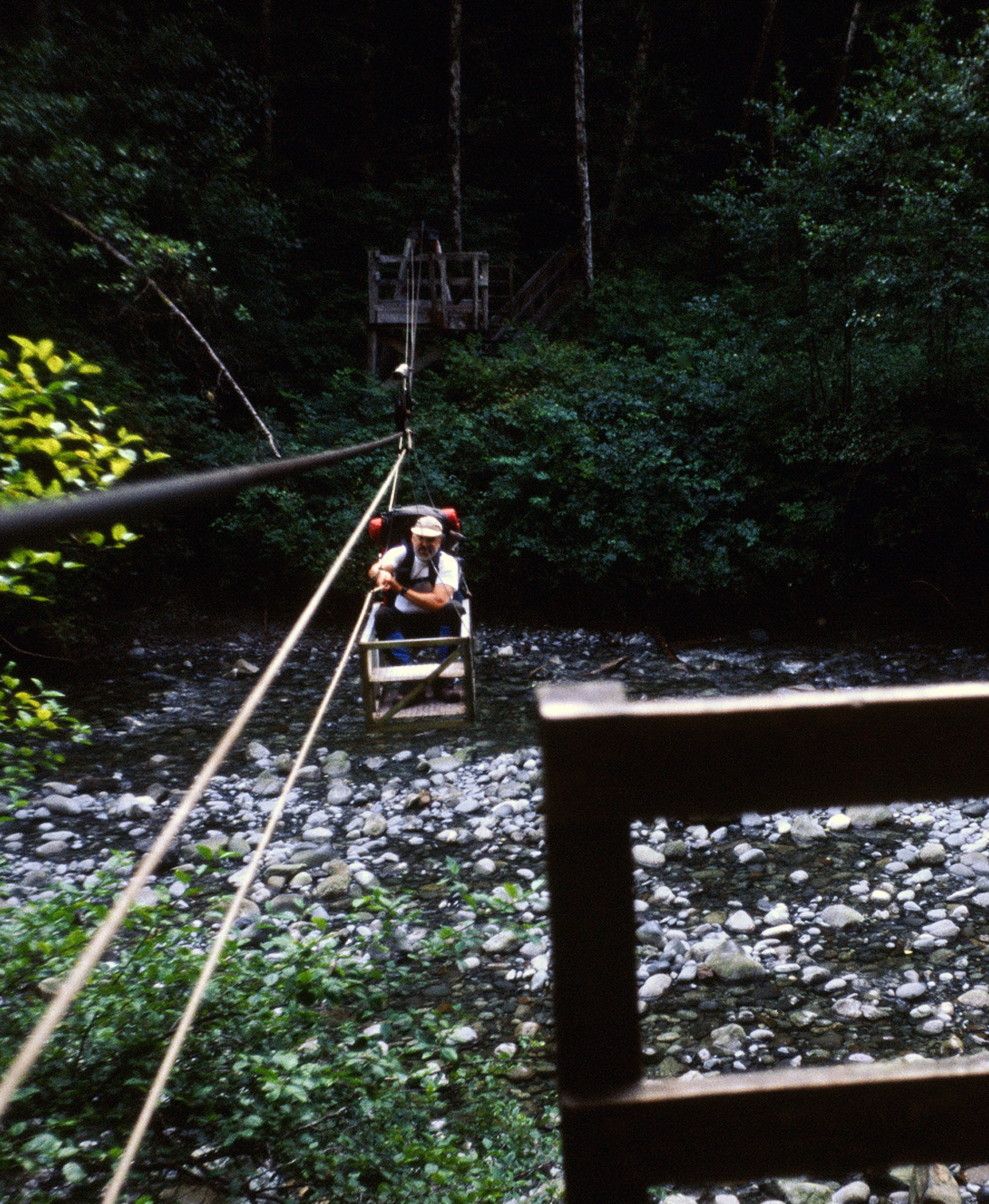
Pushed on to Logan Creek via the trail, checked out the creek mouth (not surfable), and paused for a short rest. Found two German guys camping there and a small dinghy that had washed up on the beach. Then we were back on the trail headed to Walbran Creek. The trail seems a bit better than what we experienced on Day #1, and we're making better time today. There are fewer logs to walk along, though it's still muddy and there are still lots of ladders. We may be getting better at dealing with the trail conditions and this type of hiking, which includes lots of walking on wet, slippery wood. We're told that some people wear hobnail boots or spiked overshoes to avoid slipping.
At Walbran Creek we find a broken cable car, so must wade the creek. Don and I drop our packs, change from boots to sneakers/flip-flops, and wade out to reconnoiter. We find a roundabout route by which to cross without going in the water more than thigh deep. Then we go back and get the packs, re-cross the creek, and have lunch. While we're eating, we give wading advice to some Swiss and German hikers that are headed the other direction, toward Port Renfrew.
Back on the trail we're now headed for Vancouver Point. We've been told that beyond Vancouver Point the going gets easier, and we're looking forward to that! We're also looking forward to hiking on the beach, rather than on the trail, and to more views of the ocean. We get to Vancouver Point at 3:30 PM and descend the ladders to the beach. We walk about 2 more kilometers to Kuhlat Creek, where we camp for the night. Another good campsite, with fresh water from the creek and a view of the ocean. Don and I take a nice after-dinner walk across the sandstone shelf to the water's edge and admire some beautiful tide pools, lush with life.
The weather has been absolutely perfect, after leaving Port Renfrew in a bit of drizzle. Since then we've had no rain, no fog, and no wind.
Monday, 9/9/1991
Up at first light at 6:00 AM, and on our way at 7:00 AM without breakfast. We eat home-dried apricots and pears (thanks to Larry Floyd, my tennis buddy from Sunnyside/Grandview!) as we walk. It's mostly beach hiking to Carmanah Creek, where I see the first place that looks surfable. The waves are small but the beach here just east of the creek mouth looks very promising. We cross Carmanah Creek via a long cable car and proceed on the beach toward Carmanah Point. Approaching the point we get some beautiful views of the lighthouse illuminated by the rising sun. We follow the trail around behind the lighthouse, then it's back onto the beach.
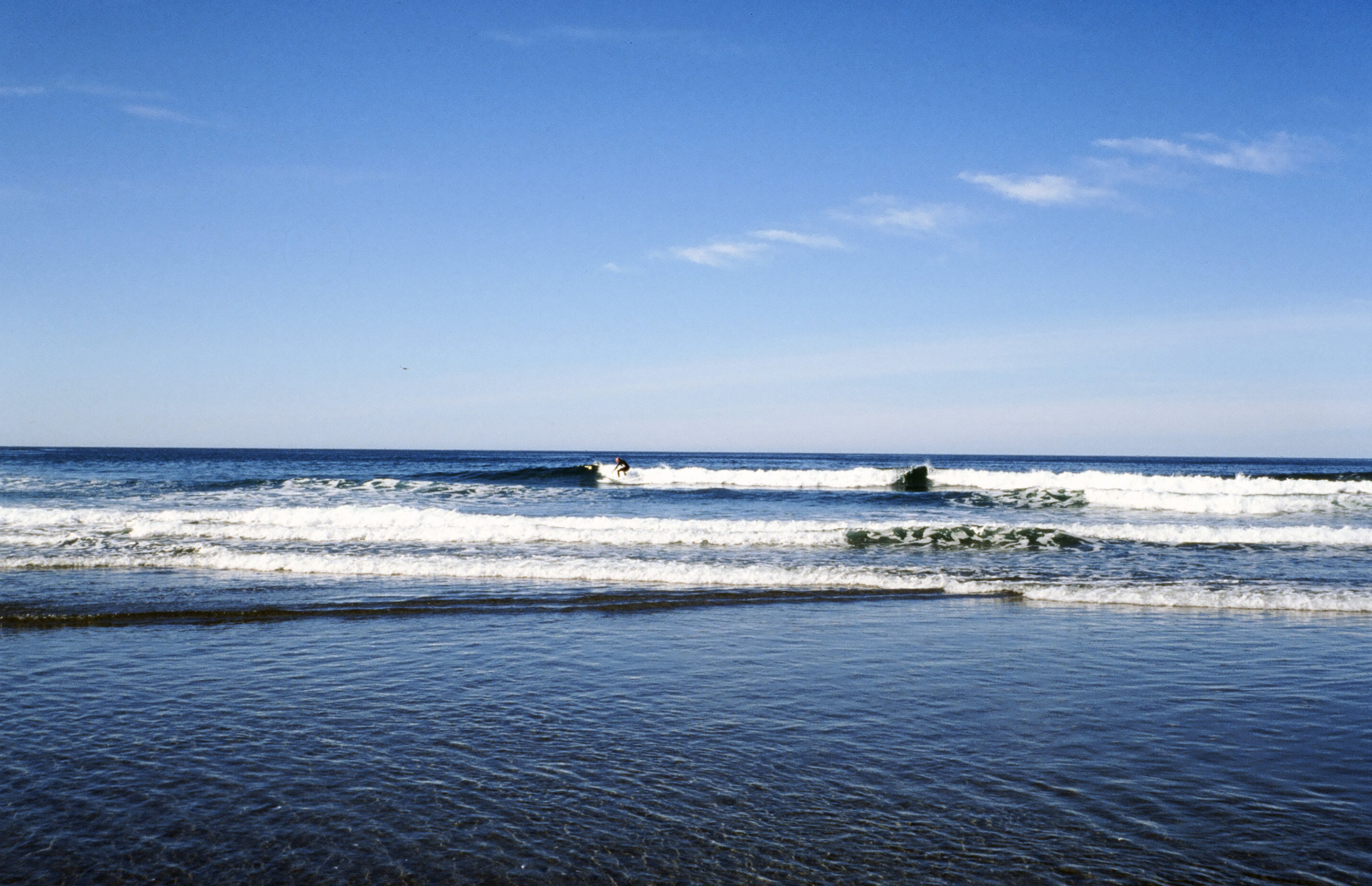
We follow the beach to Cribs Creek, where we stop for a very late (10:30 AM) breakfast. The waves here are small but have nice shape so I pull on the wetsuit and paddle out for my first surf session of the trip. There's a steep-sloping beach here with a boulder bottom - it's a very promising spot that should be great on a medium-size swell. I catch many rides, then come in and enjoy an oatmeal breakfast.
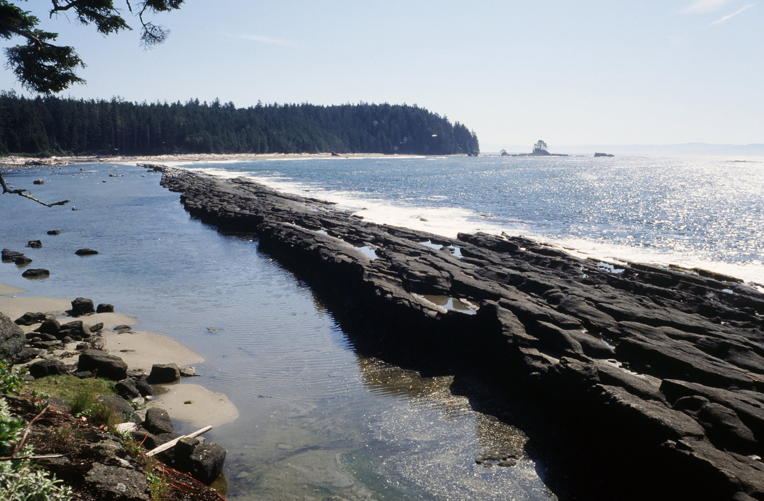
There's a very interesting rock formation here just west of the surf spot. It's sort of a natural breakwater formed by a layer of upward-tilted rock. This dark rock sticks out of the ocean and runs parallel to the beach for about a quarter of a mile. We get a nice view of it from above and to the west as we leave the beach for the trail.
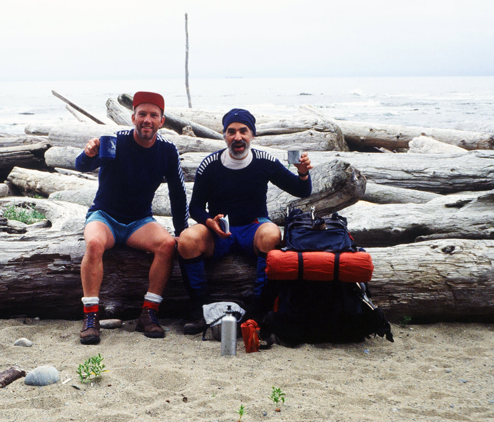
Now we must decide whether to race for Nitinat Narrows to catch the boat by 5:00 PM, or to throttle back and camp near Dare Point. We choose the latter option, and camp on the beach about halfway between Dare Point and the Cheewhat River. We have no nearby water source, but had filled up all our bottles and drank our fill at lunch, so are able to do without H2O tonight. Had another great noodle dinner with "puds" (pudding) for dessert.
We've been stopping early at night, usually around 4:30 PM, which has made the evenings a great time of eating and relaxing followed by a good night's sleep. We start the evenings with some attitude adjustment: a sip of Barack (Hungarian apricot brandy, with thanks to Paul and Clara Hoover!) and/or Bushmills Irish whiskey. After Happy Hour we begin our evening chores: setting up the tent, laying out dinner, starting the stove, filtering water, etc.
Tuesday, 9/10/1991
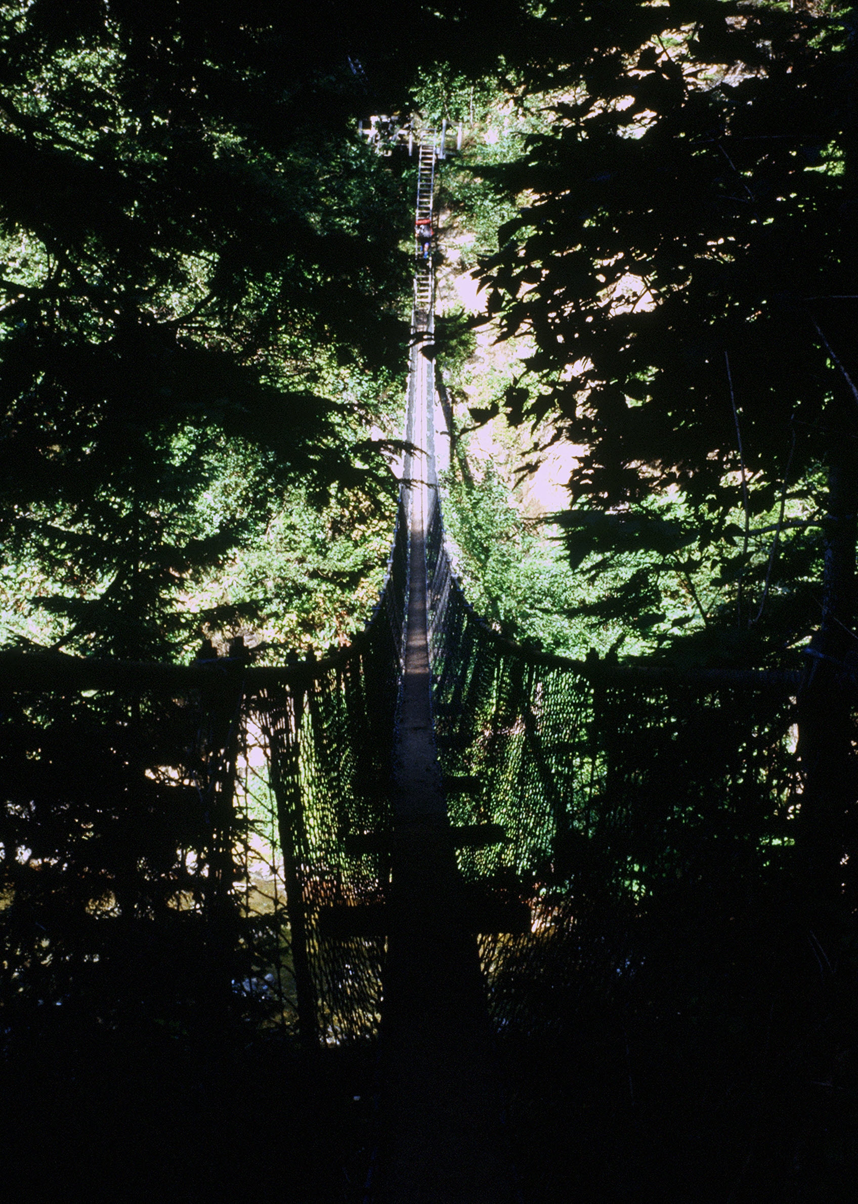
This morning we sleep in until almost 7:30 AM. Our rate of progress has been much, much faster since the midway point of the trip, and suddenly we've realized that we need to throttle back or else we'll finish the trip early. Heaven forbid having to return to "civilization"! We eat a leisurely breakfast. Don mends some broken straps on my surfboard harness. We finally get moving at 10:30 AM. We cross the Cheewhat over a suspension bridge and proceed to Nitinat Narrows, arriving just before noon, having stopped for a nice chat with a Native trail warden along the way.
We only have to wait about ten minutes on the dock before a boat comes to pick us up and take us across the narrows. It's a smaller version of the boat that we rode in at Port Renfrew - shallow draft and boxy, with a big outboard. A Native kid, probably around twenty years old, runs the boat. He takes us across for $5 each and sells us each a can of beer for $3, which of course tastes fantastic. To call him laid back would be a tremendous understatement, and we find it hard to converse with him because he and we are operating at two very different speeds. I wonder how long it would take out here for me to wind down the pace that he's living at? Maybe only a Native can get all the way there.
We eat lunch on the west side and take a picture of the water racing through the narrows, running hard upstream, as there's a strong rising tide right now. In six hours, the water will be flowing even harder in the opposite direction, driven by the level of the lake and the falling tide. We pull on our packs and start walking toward Tsusiat Falls.
We're told that Tsusiat Falls is quite an attraction, and that many people camp there. Sounds to us like a reason to avoid it, so we start looking for a camping spot right after Tsusiat Point. Bingo! We find the nicest camping spot of the whole trip just west of the point. There's fresh water about sixty yards to the west, just around a rocky outcrop. At the eastern end of our little beach is a hole in the wall, a natural arch carved through the point by the action of the ocean waves. We set up the tent on some very soft, coarse sand, and even find a wooden pallet that's washed up on the beach to use for a table. Pretty fancy!
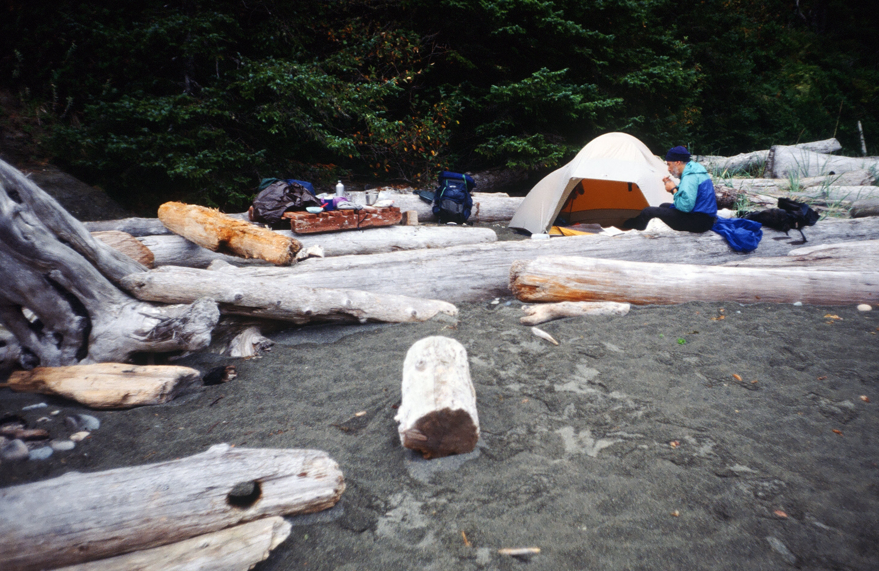
The end of the day's walking signals the start of Happy Hour. I turn my cap inside-out, rally cap style, and get the Barack (Hungarian apricot brandy) and Bushmills (Irish whiskey) from the dinner bag. We have a toast and a little sipping and conversation before starting the evening chores. Ah, but it's a fine life out here on the trail!
Wednesday, 9/11/1991
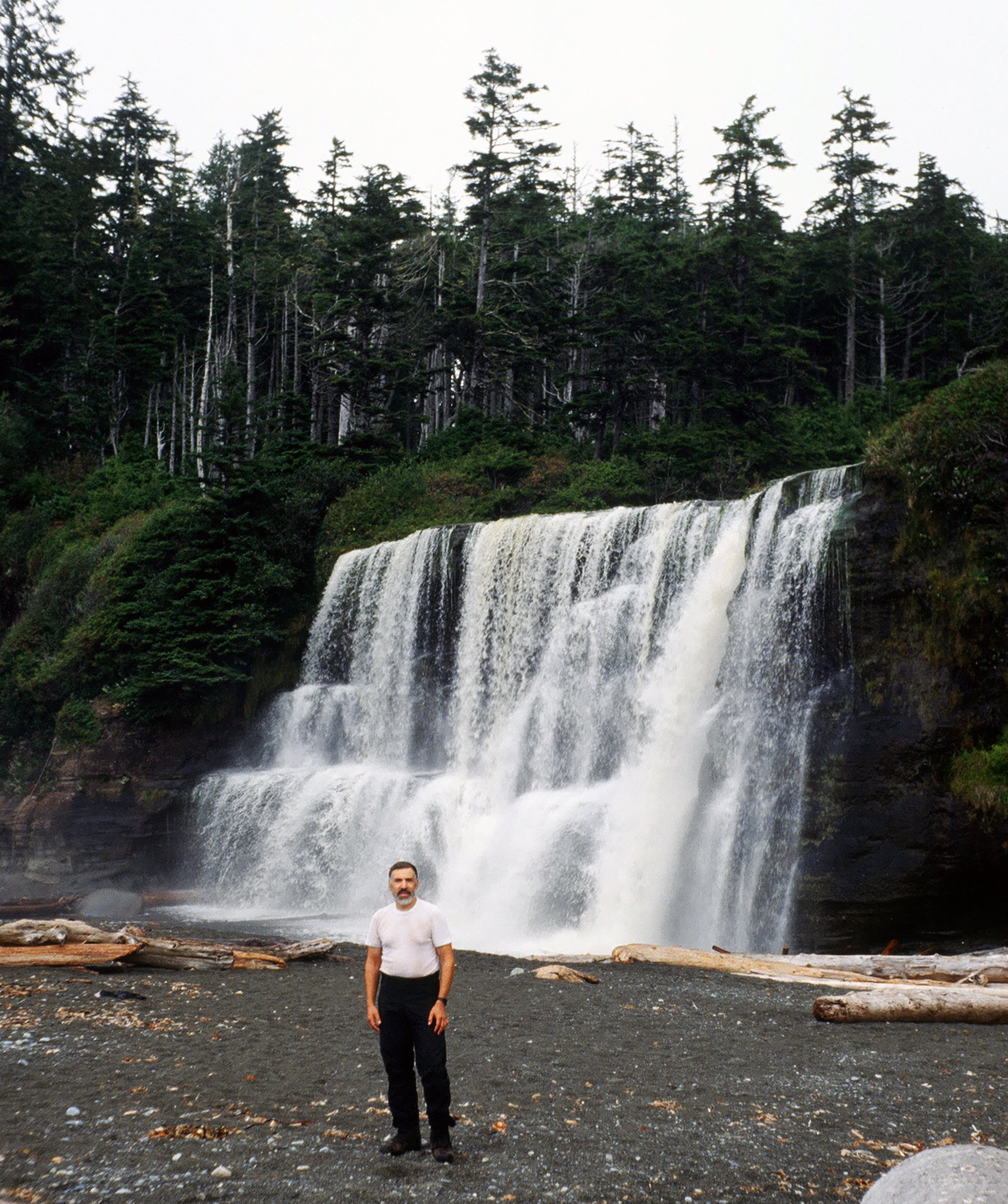
Up at 6:30 AM and we get some pictures of the hole in Tsusiat Point, then hike down and get some pictures of the falls. They're quite impressive, with a large volume of water flowing over them. Then on to Klanawa River where we share the cable car with a group of students, who must have hiked in from Bamfield. From there we take the beach to Trestle Creek, then the trail to Tsocowis Creek. At this point we return to the beach and start looking for a camping spot, as we hear that both Darling Creek and Michigan Creek have lots of campers. Having filled up all our water bottles at Tsocowis Creek, we're OK for water until tomorrow.
Thursday, 9/12/1991
Up at 6:00 AM and on the way to Bamfield. We walk the beach to Carling Creek, which we cross easily by stepping from stone to stone rather than using the cable car, as this one is reported to jam easily. We continue on the beach and rocky shelf to Michigan Creek. This is the end of our beach walking for the trip. It's about 12 kilometers on trail to the end now.
We catch a few glimpses of the seashore along the way. We stop at Pachena Point Lighthouse, where a "Visitors Welcome" sign is posted. It's the prettiest lighthouse I've ever seen, and the only wooden lighthouse remaining on the British Columbia coast. Its huge Fresnel lens was made in Paris in 1909. The lighthouse grounds are beautiful, and we get to see a Coast Guard helicopter land just as we're leaving. We walk a bit farther, then stop on the trail at Black Creek for breakfast. We walk down under the bridge to the water to wash off and rinse out some clothes, in anticipation of our return to civilization. This is my first freshwater wash since Camper Creek.
We fly through the last 10 kilometers, arriving at the Parks registration building just after noon. We find the building closed - seems that the big public employee's union went on strike while we were out on the trail. We help four Canadian students find a ride into Bamfield, as they want to get out on the MV Lady Rose and it leaves the dock at 1:30 PM. Then we hike into Bamfield, throw down a pitcher of beer and some fish and chips, and check into a hotel to wait for the bus, which will take us across the island and back to Victoria tomorrow. This wonderful adventure is over. It rains tonight, for the first time since we left Port Renfrew.